How the Technology Behind Smart Motorways Actually Works
Smart motorways rely on a network of sensors, cameras, and control infrastructure coordinated from a regional traffic management center. Inductive loops and radar detectors embedded in the road surface measure vehicle speeds, traffic density, and occupancy in near real time. That data feeds into algorithms that flag emerging congestion or incidents.
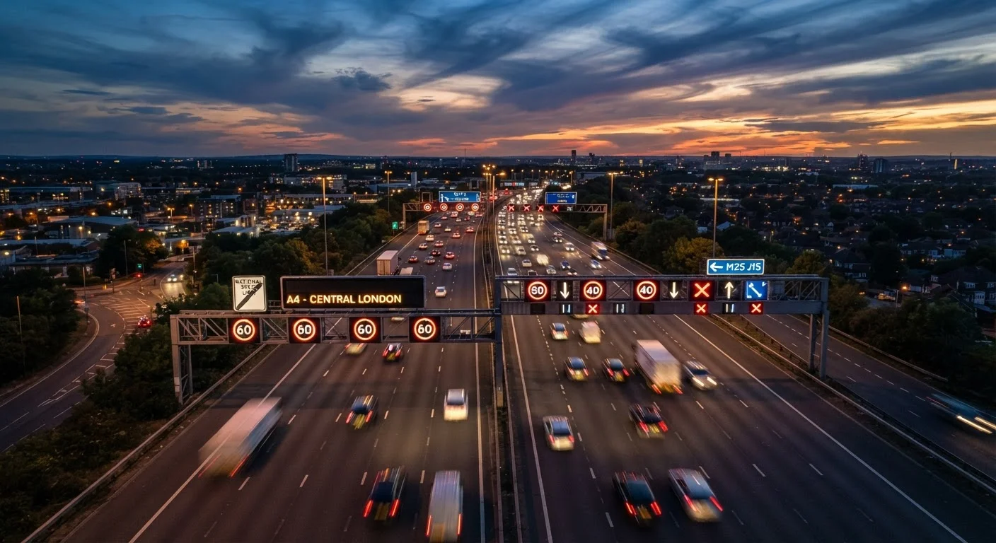
When a problem is detected — or anticipated — operators can deploy a variable mandatory speed limit (displayed in a red-ringed circle on overhead gantry signs), close individual lanes using a Red X signal, or push advisory messages to drivers. The speed reductions are designed to smooth flow, reduce the stop-start braking that causes secondary collisions, and create space around an incident.
Enforcement cameras are integrated into the gantry structures. Unlike standard speed cameras that capture a single point, many smart motorway cameras use average-speed technology over defined sections, making it harder to slow for a camera and accelerate again immediately after. Variable speed limits explained covers what each sign type means and how they differ from advisory limits.
~1.5 mi
Maximum ERA spacing on older ALR schemes
Highways England design standards have since tightened spacing requirements, but many earlier all-lane running installations were built to wider intervals.
Red X
Lane closure signal, legally enforceable since 2019
The UK government increased penalties for ignoring Red X signals following a rise in near-miss incidents on all-lane running motorways.
3 types
Distinct UK smart motorway configurations
Controlled Motorway, Dynamic Hard Shoulder, and All Lane Running each have different rules for hard shoulder use, requiring drivers to recognize which type they are on.
All Lane Running: What It Changes for Drivers
All Lane Running (ALR) is the most significant — and most debated — smart motorway configuration. By converting the hard shoulder into a permanent fourth or fifth running lane, ALR increases road capacity without the cost and disruption of physical widening. However, it fundamentally changes the safety environment for drivers who break down.
On a conventional motorway, a driver who loses power can coast onto the hard shoulder — a designated refuge separated from moving traffic. On an ALR scheme, there is no equivalent. Instead, Emergency Refuge Areas (ERAs) are installed at intervals, identifiable by their orange surfacing, blue ERA signs, and roadside SOS telephone. Reaching one when a vehicle is losing power or has already stopped is not always possible.
Road safety organizations have highlighted that stopped vehicles in live lanes — particularly before Stopped Vehicle Detection (SVD) technology has time to trigger a Red X — face a period of heightened risk. SVD uses radar and cameras to identify stationary vehicles and automatically prompt operators to close the affected lane, but detection and response are not instantaneous.
Identify Your ERA Before You Need It
When joining a smart motorway, note the ERA location signs as you pass them — they display the distance to the next refuge. Knowing roughly how far away the next ERA is means you can make a faster decision if your vehicle starts to struggle, rather than working it out under pressure.
Reading the Signs Correctly — and What Happens When Systems Fail
Driver confusion around smart motorway signage remains a persistent problem. A blank gantry — displaying no signal — does not mean a lane is definitively open at the national speed limit; it can also indicate a system fault or a gantry that has not yet been updated. When overhead signs are blank, the national speed limit applies, but drivers should remain alert to lane closures ahead signaled on other gantries.
System failures do occur. Gantries can malfunction, camera feeds can drop out, and in rare cases Red X signals may fail to deploy promptly. This is one reason highways authorities emphasize that drivers should not treat smart motorway stretches differently from conventional roads in terms of following-distance discipline. Motorway driving technique outlines why maintaining appropriate spacing matters even when traffic appears to be flowing freely.
Understanding road markings also plays a role — ERA entry points, lane delineation, and chevron patterns all carry specific meaning on smart motorway sections. What road markings actually mean provides a practical reference.
What to Do If Something Goes Wrong
If your vehicle develops a problem on a smart motorway, the priority sequence is: activate hazard lights immediately, check mirrors, and attempt to reach the nearest ERA if it is safe to do so without stopping in a live lane. ERAs are marked on overhead signs with distance indicators in advance.
If you cannot reach an ERA and the vehicle stops in a live lane, stay inside the vehicle with your seatbelt fastened unless there is a direct fire risk — exiting onto a live lane is statistically more dangerous than remaining in the car. Call 999 or use an ERA phone to alert the control center, which can then trigger lane closures and deploy highways officers.
For new drivers encountering smart motorways for the first time, motorway driving for new licence holders covers breakdown procedure alongside joining, lane discipline, and other high-speed road fundamentals.
Smart Motorway Rules Vary by Country
The term 'smart motorway' and the specific rules governing them apply primarily to England and Wales, managed by National Highways. Scotland uses comparable technology under different administrative arrangements. Drivers using these roads outside the UK should verify local regulations, as terminology and legal requirements differ significantly.